Wednesday, May 20, 2020

Farmington Canyon, Sunday, May 17, 2020


Futzing with too much gear, as usual. Life was much simpler before I started carrying cameras and a drone. View SW from the summit of Rice Peak/Bowl, with Antelope Island (r) and the Oquirh Mountains (l) in the distance.
Upper Rice Bowl, view east with the snow-capped Uintahs on the horizon.
 . . . . but back to the approach, Bountiful Peak straight ahead . . .
I give it (the sign) a year before it needs to be replaced - again - due to gunshot blasts from a pathetic 10 feet away. I wonder how many miss? "Support your right to arm Bears!" or "Support your arm to drink Beers! (rootbeer of course)"
Bountiful Peak. The center couloir is a fun ski run, but way steep and narrow. As you can see, there is a small cliff drop about mid-way down the couloir that, earlier in the season, is normally covered making the descent less complicated, unless you're much braver than I and you don't mind straight-shooting and flying over the cliff. No joking, it is really steep and you'll hit warp speed pretty damn fast if you don't make any turns. When I skied it, I booted straight up the couloir first, using crampons and an ice-axe, although, that day the snow was not rock hard so the crampons weren't  unnecessary. Kicking steps was enough. 

Intermittent snow on the approach road. I ended up booting all the way to the top of Rice Peak, never using my skins or ski crampons because the snow was mostly supportable and booting was quicker and more direct by kicking steps straight up the fall line.

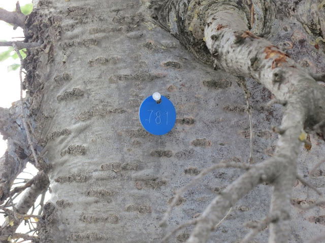
I have no idea what this means? A stand of Douglas Fir at the lower pond was marked with surveyors tape and these tags. 
Farmington Lake with its spring growth. I can't find a name for these green missiles due to their early growth. Every reference I have shows only the mature image.
Site of the January 18, 2020, avalanche fatality. The round hole in the water is where the rescuers dug 11 feet down to extricate the avalanche victim. 
Upper Farmington Lake zoomed out, avalanche debris (lower -middle) from the January 18, 2020, avalanche fatality.

Way zoomed out, upper Farmington Lake, showing the basin.


Western Spring Beauty, Lanceleaf Spring Beauty, Indian Potato, or  Claytonia Lanceolata.

Oldest rock in Utah are said to be in Farmington Canyon. I'm no geologist, but, when I see the twisted grain flow in the rock, it brings a sense of awe to consider the forces of nature over eons of time that shaped the area.  

Cornice fall created another Goblin Valley.
Walking below this (200 feet below) made me a bit nervous. If it had fallen I would be toast, so I crossed quickly.

Mid Mud Bowl is prime avalanche terrain, with many snapped trees that are bold enough to establish here.

Francis Peak form the Rice Peak ridge-line.
Sun doing its work. Sun cups form when dust is blown onto the snow surface resulting in uneven melting.

Francis Peak from Rice Peak.

View down the Rice/Mud divide. Nothing looked too promising for skiing: aspen saplings and rocks emerging out of the snowpack, wet, unfrozen snow. With a warm, south-wind blowing, overnight low temps never rose out of the 50's at 8K feet, leaving the morning snow more like like six inches of over-mashed potatoes than creamy-corn.  
View east from the Rice/Mud divide. I skied one run and got the hell out of there. Too warm and the skiing was not the creamy-corn conditions that I'd hoped for. 


Surprisingly, the best snow for turns was found in the trees. Firm, corn-ish conditions, allowing for fun, easy turns, unlike the open slopes of the upper Rice Bowl. 

Francis Peak from mid-Mud Bowl.

Nooooo! Another bush-whack while exiting the Rice Bowl back to Farmington Lakes and the Bountiful Peak road. I traversed from mid-Rice Bowl, on the level contour line, back to the road figuring that this route would be much less of a bush-whack than descending the bowl out my old, access route past the warm spring.

Another thing, I'm wearing my old Dynafit TLT6s because I didn't want to bugger-up my new Atomic Backlands while booting up rocky terrain, and, I'm remembering - the hard way - why I HATE these Dynafits. From day one in these boots my feet were in total pain. They are low volume and, even fully unbuckled, they give a vice-like feel right over my instep. Way too tight in the instep. Also, I lost most my toe-nails every winter for the four years these were my "A" boots, so apparently too tight in the toe-box and probably too short. Strangely, they are the same size (27.5) as my Scarpa F1s and my new Atomics, yet these boots feel much, much tighter than the other two. Plus the insertable tongues (as seen, currently inserted, because I'm too lazy to pull them out) are way too fiddly during transitions, hence the reason why I didn't stop to remove them for the hike out. 

Almost to the lake and the road, this is the upper basin cornice shown close-up in photos above.
Lower Farmington Lake.

 Ski tracks as seen from the road at the Sheriffs Cabin while driving home. Looks like a stupid tele-skier made those tracks, but, alas, they are my wide, sloppy ski tracks, made on AT gear with stiff boots and heels locked. I could blame those manky turns on the snow, not poor ski ability, but I hav e too much integrity to ever suggest such a thing. And just to be clear, I am a tele-skier at heart.  It's where it all started, my fondest ski memories live on three-pin gear. 

1 comment:

  1. I promised myself after going down the east twin near deseret peak that I will not use my atomic backland boots again until I get them punched. My bunions are killing me even when I wear my running shoes...even when I'm not wearing any shoes! I might need surgery.

    Pretty neat that you skied that couloir off B-peak. There's some tamer terrain off B-peak that I might try some day.

    ReplyDelete