|
| Grandview Peak from the half-pipe in lower Cottonwood Gulch. Not nearly enough snow, when it’s adequate this is wall-to-wall snow. Just around the corner the snow is gone and it’s "game-on,” war with brush that is. |
Rule #1: don’t even think about skiing Grandview if there is no snow at Rotary Park.
Today I attempted to ski Grandview Peak via Cottonwood Gulch from City Creek Canyon. I’ve used this route a number of times and it’s always been a great ski day: biking up the paved City Creek road; ditching the bike at the end of the pavement just above Rotary Park (bikes are not permitted above Rotary Park); hiking and/or skinning 1.25 miles up City Creek to the entrance of Cottonwood Gulch; skinning up the natural half-pipe of lower Cottonwood Gulch to the upper basin; skinning up the headwall in upper Cottonwood Gulch to the col on the NW side of Grandview; ridge-hop a short 1/8 mile SE to the summit of Grandview Peak. An easy, relaxed approach with a fun, easy ski descent back into City Creek Canyon down Cottonwood Gulch, that is IF there is snow cover starting at the end of the pavement at Rotary Park.
Unfortunately, today my timing was about a month off. There was no snow at Rotary Park so I hiked on the bare-dirt trail from Rotary Park up into Cottonwood Gulch. I didn’t touch snow until well into the gulch. The hike without snow was fast and easy compared to most years when the approach is usually a frustrating practice of thousands of transitions from skinning to hiking to skinning from the start because the snow is often sporadic. And believe me, sporadic snow on this approach, while slow and frustrating, it is much better than no snow. If the cover is more than 50% snow at Rotary Park then you know the brush in lower Cottonwood Gulch will be covered, and the living will be easy once you reach Cottonwood Gulch because the snow will then be continuous. Salad days.
Today the snow was discontinuous three-fourths of the way up Cottonwood Gulch. It was a living hell of bush-whacking. The worst bush-whacking in memory, even worse than the early days in North Canyon or Mueller Park while skiing Bountiful Ridge in the 1970’s and 1980’s.
City Creek Canyon is closed to auto traffic until after Memorial Day, but the snow is long gone by then. It’s a six mile pedal up the paved road from the gate up to the end of the pavement at Rotary Park. I parked at the state capital rode a half mile on the Memory Grove/Gravity Hill road to the City Creek gate, then up the canyon to Rotary Park. There I chained the bike to a tree and hiked in running shoes up the canyon trail to Cottonwood Gulch, skis on pack, and, still finding no snow, continued hiking in running shoes up lower Cottonwood Gulch. There is a natural half-pipe up lower Cottonwood Gulch, but there was no snow in the half-pipe, only satanic brush, so I dove-in and clawed up the spiky, scratchy hell for a half mile until I finally reached continuous (I thought) snow. I gladly switched to ski boots and started skinning up the half-pipe. I skinned about 200 feet and my heart deflated when I rounded the first bend, all I could see was bare ground with overhead brush. Skis off - again - and back to hiking through brush. I ended up hiking all the rest of my approach which ended at the huge Douglas Fir, the last one in Cottonwood Gulch, which stands as a beacon for the upper basin of Cottonwood Gulch. On the way up I follow the half-pipe to this Doug-Fir. When skiing down from Grandview I aim for that Doug-Fir, it marks the start of the half-pipe for a quick ski-exit down the half-pipe out of Cottonwood Gulch. Today it was just pure brush up to the Beacon Fir and once there all I could see was a wide, sargasso sea of more deep, thick brush. Total hell, so much so that I lost all heart and pulled the plug on my attempt to ski Grandview. I turned around and bush-whacked back to my running shoes, took of my ski boots, put on the runners then bush-whacked down Cottonwood Gulch to the City Creek Canyon trail, then hiked the trail back to the bike at Rotary Park. From there it’s an easy, gravity-fed pedal down-canyon to my truck at the state capital building.
All told, I wore skis all of 300 feet (a generous estimate) while skinning up the half-pipe, no turns al all because I hiked down from my high point. There was just not enough continuous snow to make it worth skiing. A shitty day from a ski-point-of view, but a great day considering I wasn’t at work.
You don’t know until you go, and now I know, don’t go unless there is snow at Rotary Park.
 |
| Analogous of my ski day, but I’ll take a shitty day in the woods anytime over a good day at work. At first I thought it was Bear shit, but upon closer inspection it appears to be Elk. |
 |
| Aaaahhhh, so refreshing, green emerging out of the snow, so much better than brush and shit. |

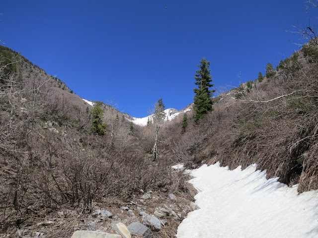 |
| Discontinuous snow in the half-pipe. When filled in with snow, the brush on the left is covered and this is fun, banked skiing. Grandview is peaking around the big Douglas Fir (upper middle, partially blocked by an aspen), it’s a beacon of sorts, it marks the delineation between upper and lower Cottonwood Gulch. When descending, aim for that Doug Fir, it marks the start of the half-pipe which makes for an easy descent-route down Cottonwood Gulch to City Creek Canyon . . . IF there is snow. |
 |
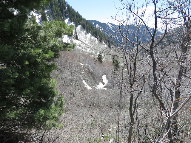
| From the brush-hell in lower Cottonwood Gulch, this is the view SW towards the ridge between Bountiful Ridge and Cottonwood Gulch. Bountiful is on the other side. |
 |
| Did I mention it was the worst bush-whacking in memory?? |
 |
| Grandview above a disheartened skier with not nearly enough snow in Cottonwood Gulch. Sometimes I amaze myself for the stupid things things I try. I’m coming back here in October with some nippers and a chain saw to do some light trail (half-pipe) maintenance. I need to make this right for next year. |
 |
| View SW down Cottonwood Gulch. The timbered canyon-wall, straight ahead, is the south side of upper City Creek Canyon. |
 |
| My transition spot from runners to ski boots then back to runners. |
 |
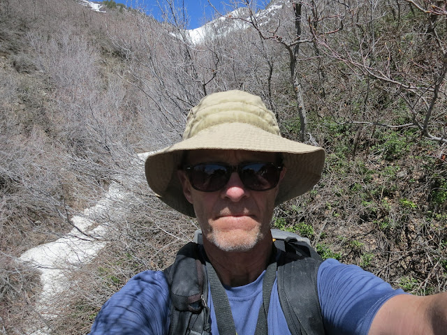
| Shit!! I may not show it but sooooooo happy . . . I’m not at work. (Serious!) |
 |
This photo shows the only continuous stretch of snow found all day. Notice no turns. By this point, sick of the skis-on/skis-off routine, I just walked. In better conditions the half-pipe has wall-to-wall, continuous snow. A month too late today.
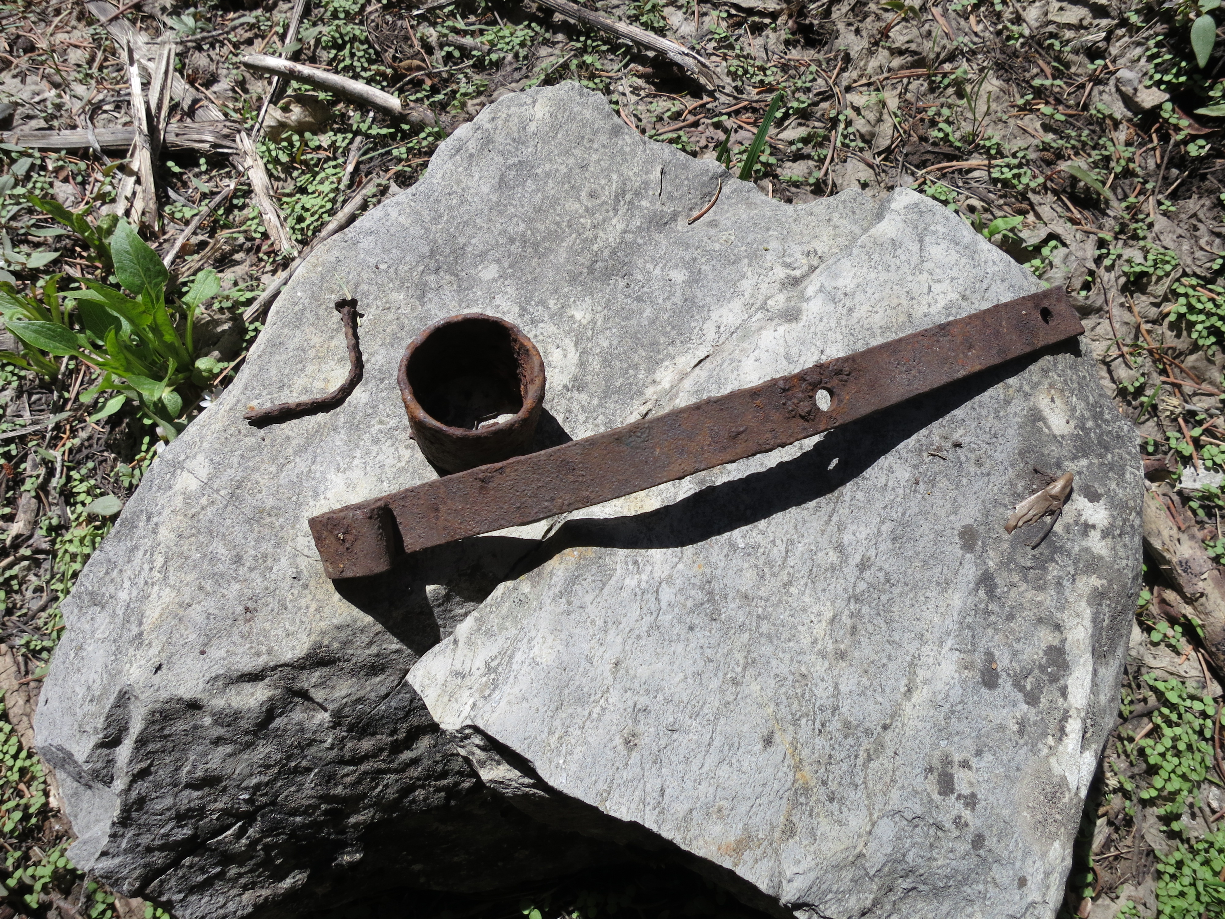
 | | Relics from the Treasure Box mine in lower Cottonwood Gulch. |
|
 |
| A relief to get out of the brush and back onto the bike for a relaxing cruise down the paved road. |
 |
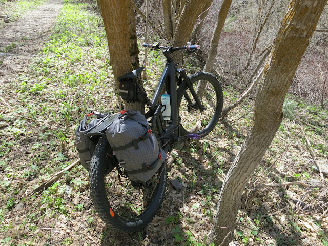
Tree in the sure spot (sic). All I can say, two trees are better than one for chain anchors when you leave a small fortune of gear at the end of a very popular canyon. That rack and those saddle bags alone cost over $500, outdoor gear is so expensive, but they make it so much easier to haul ski gear on a bike, much easier than using only your day pack. I’m not telling how much I paid (overpaid?) for the e-bike. We bought it originally for my wife after she quit riding several years ago due to the "hell-grind" of riding in the mountains, but it’s been a revelation for back-country skiing. It provides easy access up gated canyons in the spring, making the access an after-thought rather than the most significant energy out-put of the day. If nothing else, when time is short the e-bike provides for a quick hit rather than an all-day expedition. You fly up the canyons and your focus is on the skiing, not the grind of getting to the skiing. Most importantly, Kara is riding with me again.
Several young friends give me shit for riding an e-bike to ski, saying it’s cheating, that real men DO NOT ride an e-bike, pedal the approach on a real bike otherwise your ski-day does NOT count. But those same young friends think nothing of driving their Dad’s Volvo from Bountiful to Alta to 'back-country ski' Grizzly Gulch (it’s groomed by Alta Ski Lifts). Transportation is transportation. What’s the difference? |