Friday, February 22, 2019

Rudy's Flat, February 22, 2019


Kara and I were supposed to be in Ketchum Idaho this weekend skiing, but Kara got the flu and I have a painful muscle tear from running on an icy trail earlier this week, so we postponed the trip to Sun. Valley.

For my leg the Doctor prescribed rest and compression sleeves on my legs, but the sleeves are  a total gimmick. My leg still hurts, especially when on a steep climb, plus they cutoff the circulation to me feet, resulting in my toes getting cold way more quickly than normal. Today they went numb just 20 minutes into the skin track. Plus skiing with Jonah is not restful, at least physically. He's always a joy to ski with, always a smile and a great low-key persona, but on the skin track he charges hard and it’s tough to keep up.

Kara's Pot Farm with the saplings fully buried. The cover hasn't been this deep in  at least five years.

Jonah and Harrison. Harrison charges too but today was his very first day touring,. and he did it on totally unfamiliar gear. Those G3 tech bindings puzzling. It took me ten minutes to figure out how to lock down the brakes for skinning. But Harrison is a force. A few more days of experience and he'll disappear up the hill with Jonah while I flounder way behind.

Jonah charging! Today the forecast called for sun but it snowed lightly the whole tour, with some wind and frigid temperatures. Not the best day to try out my new compression sleeves.

The "snow stake rock" is just a foot above the surface. In the summer it is at least four feet above the mountain bike trail which runs right past the base of the rock.

Harrison (l), Jonah (r).

160cm (62in) at Rudy's Flat (7,100ft).

You know it's cold when your nasty, sweat soaked bandana is as stiff as fine china, but I wouldn't eat off that bandana.

Jonah and Harrison on the flats. This was our high point for the day due the setting sun, the collapsible wind-pillows we crossed just down the trail - not a good indicator of conditions above on the ridge -and my hurting leg and frozen toes. I couldn't skin up anything steeper than about 15 degrees without sharp pain in my left calf, but if we'd started two hours earlier everything would've been different. My pain would've disappeared and we would've skied the good stuff off the ridge above.
  I'm the designated excuse maker on the team and I'm quite skilled if I do say so. 


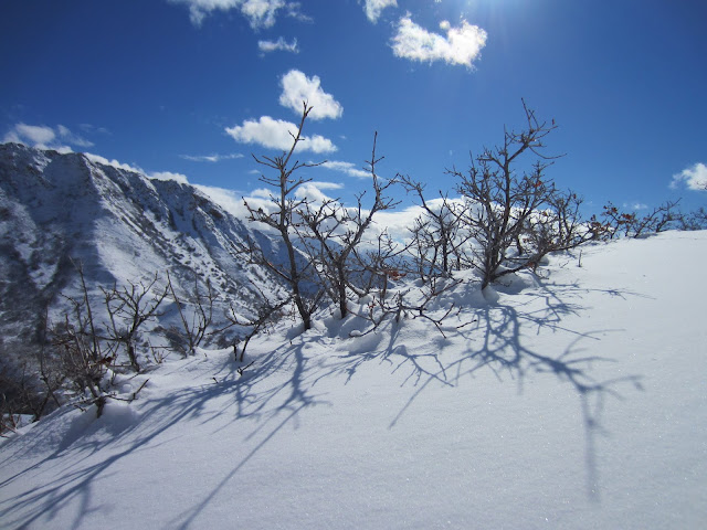
The setting sun brings beautiful light on this winter evening. View NW looking over the top of Kara's Pot Farm with
Davis County beyond. 

Bountiful Ridge looking deep. It was tough to walk away today but see my multifaceted excuses listed above. The nuanced complexity of my excuses is World Cup caliber. I RULE when it comes to making excuses.

On the "Traverse" from KPF to the summer mountain bike trail. KPF may not be the shortest shortcut to Rudy's but it's definitely the cleanest and most open route though a major natural barrier to access, also known as Gambler Oak.

Nice turns on lower Kara's Pot Farm,

Now, can you kind of visualize why Gamble Oak is such a  major pain-in-the ass?  My new Black Diamond soft-shell ski pants are toast, courtesy of a dead snag aimed directly at my sore calf muscle. I'm thinking Gorilla Tape and few staples will fix it. You can see my compression sleeve through the tear. Damn! I look so geriatric!


Beautiful light as the sun sets.

Sunday, February 10, 2019

Forbidden Fruit: Skiing Red Butte Canyon, February 8, 2019


Skiing forbidden ground.
Cloudy at the start but the sun came out for runs two and three.

First run tracks. 

Across the canyon on Mt. Van Cott, foothills skiers everywhere during this heavy winter.

Red Butte dam and reservoir. This area is a restricted nature preserve and I unintentionally entered and skied the restricted area. It was an innocent mistake, I followed the Red Butte Gardens High Country Trail, a public trail, up to the 90-degree bend west, but instead of going west I headed east. There were no "Keep Out" signs or fences where I left the public trail, and I skinned only a quarter mile from the trail to my ski run. I only found out that I was on restricted grounds when, on my exit at the foot of the hill, I ran into a barbed wire fence, with me on the wrong side. The photo below shows where I crawled underneath to get out, and only there did I see a "No Trespassing" sign. 

Ski tracks from runs one and two. Red Butte Peak is the high point above.


Skin track through beautiful snow on a cold, sunny day.

Kind of brushy and rocky in spots. I hit ground and rocks often, but overall not too much damage.

Runs one and two from the top.

Red Butte dam from my high transition point. (skins off). 

View up from may low transition point (skins on).

Ski tracks, runs one, two and three, with cool clouds streaming overhead.

View west over the Salt Lake valley from near my high point.

I'm locked inside the nature preserve, on the wrong side of the barbed-topped fence. The thought crossed my mind to just drop into the creek and crawled under the fence here. It looked to be about a foot-and-half higher than the flowing water, but the water was about eight inches deep and running fast on a mossy concrete chute. I saw visions of me slipping and falling in to the freezing water, then sliding along on the mossy sleigh ride. Instead I opted to hike up the fence-line to the top, which I guessed was a half mile up the hill, near where I originally left the public trail.

View up the hill showing the fence-line through the trees.

Whew!! A hundred yards up the fence-line I found this hole, which was barley big enough to crawl under. The Red Butte Natural Research Area should place signage up higher on the public trail. Presumably they haven't because most folks just stay out. I'm a slow learner. 

My tracks as seen from the end of the public access on the Red Butte road. Three runs at about 450 vertical feet each. Short, but fun. My first two runs (left two) I skied like my 1970's upbringing taught me: short, quick slalom turns, but I hit ground or rocks on almost every turn. On my third run (right) I tried big, giant slalom turns, allowing the skis to float, and I then never hit ground. With about 13 inches of snow on this grassy slope, just barely enough for skiing. 

Zoomed out with the Red Butte Ridge-line seen above.


Mt. Van Cott, February 7, 2019

Back up Mt. Van Cott for the second day in a row, but what a difference a day makes. Sunny and beautiful, but still cold and I'm still breaking trail through deep snow.

Red Butte Peak to the south.

Knee-deep trail breaking on the Mt. Van Cott south face trail. View east up Red Butte Canyon. 

Red Butte Canyon (left), Red Butte Dam/Reservoir (lower, middle), Mt. Wire (highest point, in middle of photo, peeking above Red Butte Ridge) and Red Butte Peak (lower high point on right).


Mt Van Cott summit from about 1/8 mile below.

Summit drift.


Summit cornice is about 10 feet deep.

 
View up Red Butte Canyon from the summit of Mt. Van Cott.


View south of the Salt Lake Valley.

Red Butte Peak

Mt. Olympus (middle) and Lone Peak (r).


My descent track down the Water Tank trail of Van Cott.

View west from the water tank on lower Mt. Van Cott.

Mt. Van Cott, February 6, 2019


At almost 57-years-old I've never outgrown recess. I try to go trail running every day during my lunch break, and it works wonders when I can get out. I come back alive and energized. My mind is clear and I'm alert the rest of the day. When I don't, my head is bobbing by 3pm. It's a battle staying awake until quitting time. 

I'm lucky to work at Research Park which is part of the University of Utah. My office building is in the foothills (literally) of the great Wasatch Range of Utah. Just 100 yards out the back door and I'm on a trail heading up a myriad of peaks or canyons, Mt. Van Cott, Red Butte Peak, Mt. Wire, Red Butte Canyon, Georges Hollow or Dry Creek, to name a few.

Today there was 15 inches of new snow at work (5,000 feet) and about 24 inches up to 10 foot drifts at the summit of Mt. Van Cott (6,340 feet). I had to get out into that snow, so I went running, OK waddling, through that snow headed for MVC. It was cold, low 20's but colder with the windchill, more like low teens, and I was freezing from the start. MY light gloves (thin liners which are normally ample for a run) were not working and my fingers were soon numb, so about 3/4 the way up I turned around to head back to work. But after descending maybe 30 feet my conscience got to me, I just could not stop now, so I turned around - again - and wen to the summit of Mt. Van Cott.     

Ten foot drifts on the summit ridge.

Happy face, too cold to smile.


As shallow as it got.

Sun briefly peeking through during the descent.