The first half of March was definitely like a lamb, the temps about 10 degrees above normal, but the last half of the month saw a return to winter, slamming the door on another early summer which has been the norm for the last decade. Today's conditions were way over-ripe. There was no refreeze last night and by mid-morning the temperatures at 8,000 feet were in the low 50's. The snow was wet, slushy and very slow, almost too slow to turn or else it would stop me in my tracks.
 |
| The North Canyon road was still too snowy to drive so I booted from the end of the pavement . . . |
 |
| . . . which meant this. Snow, mud, snow and more mud. The snow was not continuous until reaching the 'rocky switchback' just below Rudy's Flat. |
 |
| When spring hits I wear the crampons full-time, along with my skins. The snow conditions are just too variable and if I you wait until the crampons are actually needed it's often too steep, icy and awkward to take of skis to mount up. When skinning a steep slope they are mostly unnoticeable. On flatter terrain it's impossible to kick-and-glide. |
 |
| KPF |
 |
| Glorious! Sun, snow and mountains. |
 |
| B-ridge, from the shortcut traverse. |
 |
| My snow stake. The top of this rock is roughly four feet above the ground, so today we have about 24-inches (1/4 mile SW of Rudy' Flat at about 7K feet). |
 |
| Arriving at Ruy's Flat with my bow-legged stride self evident. |
 |
| The real snow stake (avy probe) at Rudy's Flat (7.1K feet). 132 centimeters (51 inches), which is double the coverage compared to the rock, a quarter mile down the trail. |
 |
| I know, I know - weird habits - placing rocks in tree-crotches only to see if anyone notices. This one is 6.5 feet off the bare ground during the summer and the last time I replaced it was last October. There is another 'tree-rock' set in a Mountain Mahogany on the ridge above, and it has remained there for over a decade. Surprising because it's right next to the summer trail and only about four-feet off the ground. |
 |
| Chickadees handiwork. |
 |
| 178 centimeters (71 inches) in mid-Rectangle Bowl at about 7.8K feet. Aspect is everything, this spot is a NW aspect about 3/4 miles from Rudy's Flat, with substantially more snow. |
 |
| I was surprised the cornices weren't huge given the big winds we had the last few weeks. View S. |
 |
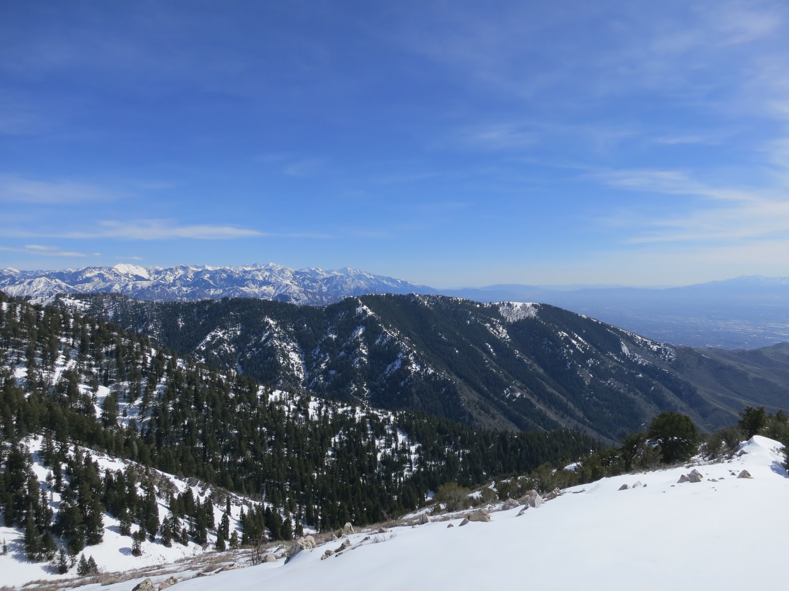
| View SW towards the Oquirhs with the City Creek Canyon/North Canyon divide in the middle. |
 |
| Topping out on Rectangle Peak. |
 |
| View NE and Sessions Mountain. |
 |
| View N: (right to left) Sessions, Bountiful Peak, Frances Peak and Thurston Peaks, with Ben Lomand peeking over Thurston's shoulder. |
 |
| Tree moss, which is not common in the Wasatch. This caught my eye from a long way off with the green being a total contrast to the white and gray of winter. |
 |
On my exit run I like to ski the glades down the fall-line to the Mueller trail. This is at the last bridge (hidden under snow) when mountain biking riding from Mueller's to Rudy's.
|
 |
| KSL's chopper did some touch and goes on Rudy's Flat . . . |
 |
| . . . so I had to leave my mark. |
 |
| Tire tracks still visible in the mud from last fall. |
 |
| My tracks down the Rectangle. |
 |
| I heard voices well before seeing these guys. |
 |
| Lower KPF drainage. |
 |
| Really?? By all means, tat the hell out of your body but leave the trees alone. |


