Friday, May 26, 2023

Aoraki - Mount Cook, Hooker Valley Track, New Zealand, February 11, 2023

Aoraki/Mount Cook (12,218 ft) from about 30 miles away, as seen from the south end of Lake Pukaki (elevation 1,765 feet). Aoraki/Mount Cook is huge, rising over 10,000 feet above it’s valleys. In comparison, the Grand Teton rises only 7,000 feet above Jackson Hole. Lake Pukaki is massive, about 30 miles long and 5 miles wide, and, Like Lake Tekapo, its a moraine-damned lake, forming when receding glaciers from the last ice-age (15K years ago) left a deep valley with their terminal moraines damning the melt-waters. 

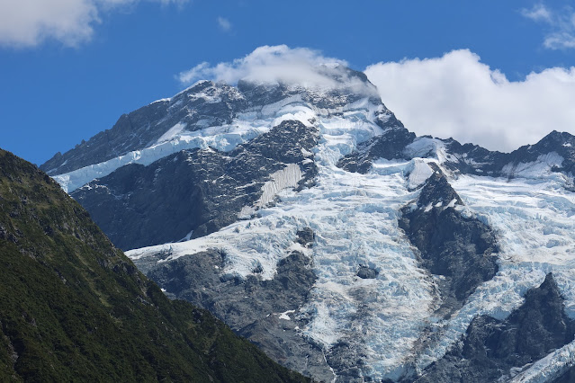
Mount Sefton (10,338 feet) from the Hooker Valley Track trailhead (2,490 feet). 

Mount Sefton (10,338 feet)

Mount Sefton (10,338 feet) from the Hooker Valley Track trailhead (2,490 feet). 


Lake Mueller and Mount Sefton, as seen at about milepost 1.5 on the Hooker Valley Track. Mueller Lake wasn’t here 100 years ago, rather, the Mueller Glacier, seen above, filled the valley where the lake now sits, with several hundred feet of ice. The barren lateral moraines above the lake show the depths of the glacial ice of the early 1900s. From where I was standing to take this photo, if it were 1923 the edge of the glacial ice would be about 50 feet away from my toes.

Aoraki/Mount Cook about two miles up the HookerValley Track. 

Aoraki/Mount Cook 

Aoraki/Mount Cook (12,218 ft) above Hooker Lake. The Hooker Glacier, at the far side of the lake, calves icebergs into Hooker Lake. The lower edges of the glacier are covered in dark scree, hastening the melting, but look closely and you can see the ice-cliff of the glacier running into the lake.  

Icebergs above our shoulders on Hooker Lake.

Aoraki/Mount Cook (12,218 ft) above Hooker Lake and icebergs on Hooker Lake.

Aoraki/Mount Cook (12,218 ft) 


Mount Sefton (10,338 feet)

Mount Sefton (10,338 feet)

Aoraki/Mount Cook (12,218 ft)

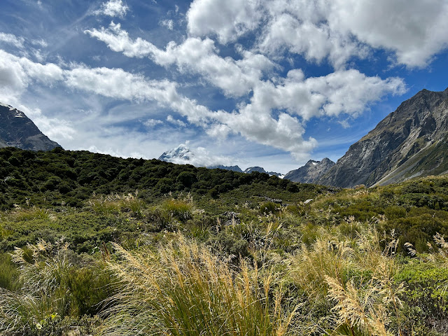
The Hooker Valley Track (trail) is an easy six mile round-trip walk, with barely a rise in elevation, up a glacial valley to Hooker Lake. It’s crowded, don’t expect solitude, and we were told by our landlady in Lake Tekapo that it’d be tough to find parking given that it’s mid-February, the height of New Zealand’s holiday season. I expected it to be similar to going to Zion or Arches National Parks in early August, but we pulled into the parking lot mid-day and immediately found several open spaces. No cruising the parking lot waiting for someone to leave. The trail was crowded, but not nearly as crowded as hiking Delicate Arch or Angels Landing in August. Compared to the USA, New Zealand is sparsely populated, it just does not get the crowds of the National Parks in Utah, or Wyoming.     

Climber memorials at the Hooker Valley Track trail head.


Christchurch to Lake Tekapo, New Zealand, February 8th - 11th, 2023


It may be the best ski season ever for the Wasatch, but for me it was lifesaving to get the hell out of Utah.  Even if for just two and half weeks, it was a much needed reprieve from the crazy-shit that has consumed the USA. Unfortunately, Utah has embraced the crazy. Everyone has a secret, and my coffee drinking certainly raises eyebrows in the community, but my secret is quite benign compared to the hard-lines adopted by so many around me. 

New Zealand was a great escape. After the long flights, we spent one night in Christchurch then drove to Lake Tekapo (3hrs, 224kms/139mi).


OTAUTAHI, Maori for Out-of-Utah? Maori for Christchurch.

Lake Tekapo, Mt John, February 10, 2023

I got sick on the flight over, bad Bronchitis and Conjunctivitis (Pink Eye). The second day in NZ, the first morning at Lake Tekapo, it hit with a vengeance. My eyes were glued shut and my lungs were full of liquid. I felt OK when I was outside walking or hiking, but as soon as I stopped moving I couldn’t breath, so I just kept moving until dark. Days were heavenly, nights were hell. Driving on the wrong side of the road with pink eye was an adventure.

Lake Tekapo from the top of Mt. John, an easy 2 mile hike, or an even easier 5 minute drive.


Lake Tekapo, elevation 2,330ft, 17mi long, 2mi wide, 390ft deep. View from our room. 

Front door view.


Observatory and Cafe (pronounced ‘Caf’ in Kiwi) on the summit of Mt. John


Church of the Good Shepherd, interdenominational, built in 1935, Tekapo New Zealand.


Thursday, May 11, 2023

Cowboy, City Creek Cirque, & Crows Foot, February 3, 2023

First time to share a skin track with a Cowboy on horseback . . .


Just below the steep scree-slope on the Hidden Lake Trail, the Cowboy tied his horse to the scrub and booted to the top of Stonehenge Peak. When I got to the top he was scoping lower City Creek Canyon, looking for Elk, wintering low during this deep winter. He was a very nice guy, the way we all should be, quick with a smile and a "hello.” A bit older than me, and very genuine and friendly, like an older brother I hadn't seen in years. He said he has lived in Centerville since a kid, but he didn’t know my name when I mentioned the Reeder’s have lived in Bountiful since the early 1960’s. He said he likely knew my older brother Stuart, who was in the Bountiful High Marching Band in the early 1970’s. The Cowboy said he was in the Viewmont band at the same time and the school's bands often interacted. I couldn’t see the Elk but he handed me his binoculars and told me where to look, and sure enough, there were about 50 Elk near the bottom of City Creek Canyon, just above the road on the warmer, southern aspect (north side) of the canyon.  


The Cowboy booting up Stonehenge Peak, next to my ski tracks from three days ago. 

What are YOU lookin at? That horse glared at me as I skinned by. I kept my distance, remembering my Mom’s lecture when I was a kid when we went to the family farm for a reunion, "never stand behind a horse, they’ll kick at you if they can’t see you.” What does an Australian lady know about horses anyway? But I believed her, and now, maybe 56 years later, I still hear her Aussie voice, lecturing on horsemanship.    

Seems like every ski day this year was gray and overcast, and cold and windy. The started out sunny and bright (horse pics) but it quickly went gray and overcast.


Two cameras but a big differenece in how they handle bad light. This photo and the other self portraits were taken with a GoPro Max (yellow hue), most of the others came from with a Canon G7X Mark III (blue/gray). Both were set on ‘auto.' When I tried to play with the exposure the photos were even worse, either totally washed out or way darker, so I evnetually just them on ‘auto.’ I even carried my drone today, but the light was so bad it never came out of the pack. The GoPro is much better with contrast but the Canon has much sharper focus across the frame, but only with plenty of light. 


One day I need to drop that cliff and I may have missed my chance because the base was deep this year. Normally the base is only one or two feet deep and that cliff is bigger than it looks, 15-20 feet depending where you drop, so I haven’t trusted the landing. I should have done it today, but this spot is strangely remote and gets no traffic (why I ski it). If I snapped a femur my body would still be there . . . or not, just my skies would remain, the Coyotes and critters would have scattered me in a matter of days.   

Weird cobbled rock along the skin-track out of City Creek Cirque, consisting of small stones cemented within a sedimentary rock, a reddish, soft concrete. The rock is soft, it cracks and breaks much easier than the Granite (Quartz Monzonite, Igneous) of Little Cottonwood and Bell's Canyons or the Quartzite (sandstone metamorphosed under heat and pressure into a harder rock) of Big Cottonwood Canyon. The cobbled conglomerate above Bountiful and City Creek Canyon (called Knight Conglomerate?) stretches from South Davis County on the north to Emigration Canyon on the south and East Canyons and Echo Canyon on the East. The conglomerate cliffs are full of small caves and a few arches, and it calves boulders like séracs off an icefall of a hanging glacier. I see huge boulders everywhere, broken away from its parent rock by a few inches, teetering and waiting for the next freeze/thaw before calving off. Makes me nervous to ski below them. I see slides and rock-fall frequently near those cliffs.   

One of the detached blocks near the top of City Creek Cirque, sure to break free sometime soon, hopefully not when I’m underneath.  (Photo taken May 15, 2023.) This one is about 8 ft high x 5 ft deep x 10 ft wide. I ski or run past this spot a hundred times a year and that crack is getting wider. A year ago it was a quarter-inch wide. Freeze/thaw/tree roots, all conspiring to push this off the edge.   


Skinning back up out of City Creek Cirque, along the ridge. I didn’t realize there is a huge drop just off that ridge when I first skied this a number of years ago. Big, cobbled cliffs drop away just a few feet off the other side. And those cliffs are everywhere. They don’t look like much from the city, but at close range they are intimidating, some are over 200 feet high, and dropping away over blind roll-overs. What looks like a fun, steep ski slope, with a convex drop hiding the base, is actually a big cliff hiding the lower end of the run. With hard, icy conditions, one could slide for life off the edge. Safe route-finding is often overlooked in foothill skiing, City Creek and the Bountiful foothills should not be taken lightly. If this was 2,000 feet higher and got the deep snow of Farmington Canyon, this wood be a cliff-dropping mecca.   


Entry into City Creek Cirque.

So gray I could hardly see my first-run tracks down CC Cirque.


Two runs and skin track. Short, perhaps not worth the effort, but still sweet. 

City Creek Cirque had about a 48 inch base, but while skinning back up, on a slope a few degrees to the north on a southern aspect, the base was much thinner, maybe 15 inches.  


Second run skinner. Just over that ridge is a 100 foot drop.

Too scared to drop the cliff I traversed over to a small notch in the cliff. Last summer I hiked over for a closer look and was surprised to see that the notch was almost vertical, and bigger than it looks in winter, about 20 feet. It’s amazing how rock fills in quickly with a little snow.


Skinning out of the Cirque, my tracks and second-run skinner barely visible in the flat light.

My only photo of my exit run down the Crows Foot. The light was too gray and my photos are bad. With no contrast the turns are barely visible, but look hard, and you can see my turns down through the Mt. Mahogany.

Out of sight are my turns down the Crows Foot Couloir, a steep notch through the cobbled cliffs. It’s only skiable under deep conditions due a vertical drop midway down, so it takes time for snow to fill the drop. Skiable maybe once a year - at best - and only after a big dump. This year was an absolute anomaly, the Couloir was skiable from January through mid-March. Some years it is never skiable unless one is will to drop a 15 foot cliff onto a thin snow landing on a cobbled-rocky base. I’m too old to break any more bones, I ski it only when it's deep.

Today I skied down the upper Crow’s Foot Left Toe, then left and down the Couloir, then back over to the lower Left Toe, seen here through the Mahoganies.  After skiing the Crows Foot I then skinned along the Bonneville Shoreline Trail to get back to my truck.  Before the BST was built there was a long bushwhack to get out of this place, which left me wondering why I kept going back, and I did it way too much. I did it often when avy conditions were dicey on bigger terrain, or I just need some adventure. Cobble and Oak brush is mostly adventure with a few good turns here and there.