Friday, October 30, 2015

Pfeiferhorn with winters first snow, via Red Pine Lake, October 30, 2015


Winds blowing snow off of Monti Cristo.

Tanner's Gulch, Dromedary Peak (hidden by middle tree), Sunrise Peak (middle), O'Sullivans (middle left) and Broads Fork Twins (far left).

The Pfeif and its notorious access ridge. It's really not too bad. Plenty of holds and negligible exposure. Even with new snow the crossing felt safe.  

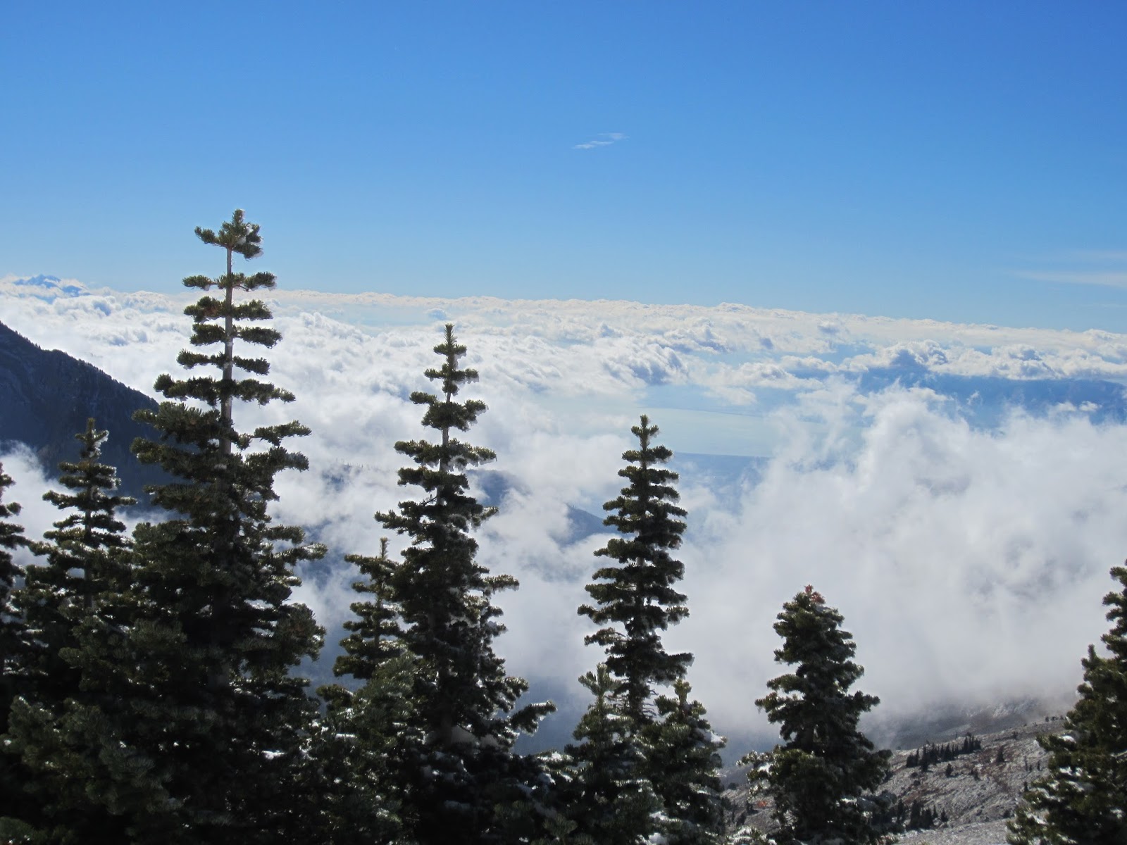
Low clouds rolling in from Utah Lake. Box Elder Peak (near) and Timpanogos in the distance (middle left).

Lone Peak  is the 'W' shaped peak in the middle (on skyline) and upper Hogum Fork (head-wall on right and shadowed cliffs. Airplane Peak is the near peak in the middle, named for a a crash on its flanks in the 1950's (?) killing 12 people, and not found until the following spring when the winter snow melted. 

Summit of the Pfeiferhorn overlooking Utah County, hidden in clouds.

Selfy on the summit. I hate selfies but had to prove I summited the Pfeif.  I read somewhere that people who take a lot of selfies are prone to be sociopaths. I love people! Sure glad no one else is here! 

Timpenogos.


Upper Maybird Gulch from the summit of the Pfeiferhorn.

Broads Fork Twins. 

The infamous NW Couloir (ski run) of the Pfeiferhorn. Down in the shadowed choke there are two bolts, an anchor to rappel a 40-foot cliff, with your skis on.

Hoar frost on the summit blocks.

The access ridge straight ahead and upper Maybird Gulch (shadowed cliffs).

Looking back at my tracks on the summit headwll.

Don't slip! A bit of exposure on the ridge. 


Timp


Red Pine Lake and Little Cottonwood Canyon.

Red Pine Lake with Sunrise Peak peeking through the clouds.

Lone Peak via Jacob's Ladder, October 1, 2015

Today, we (me and a couple of work chums) hiked Lone Peak via Jacobs Ladder. The plan was to start at 6AM, hike up Jacob's Ladder to the Lone Peak Summit in under three hours, then run down in two. We hoped to get to work by noon. The reality is we didn't start hiking until 6:40 or so, it took us 3:08 up, longer than expected due to my bad route-finding through the boulders on the east side of the cirque (we could've shaved 20-30 minutes if we'd just stuck to the trail), then we lolly-gagged on the summit for about half hour, and ran down Jacob's Ladder in two hours. We made it to work just before 1PM. Suck! Why'd we go to work?


Lone Peak Cirque. The summit is the high point on the left, the Question Mark Wall tops out at the high point on the right (middle of photo). About ten years ago I climbed the Open Book Route on the summit wall with Brett Fuller. About half way up we started hearing many squeaky voices and when we pulled over the last wall we were horrified to see about 25 Boy Scouts squeezed onto the summit. Horrified because the the summit block a flat block of roughly 8 X 10 feet (and that's generous) with 400-500 foot vertical drops on three sides. I've know folks who refuse to stand up on that thing for the vertigo inducing feel when there is nothing to grab if one trips. A little pushing/tripping/ and one of those tenderfoots would've gone right over. But I was more horrified by the though of one of them dropping a rock down on top of us.  Luckily, no rocks hit us and no Boy Scouts fell off.

Me (r-back) and chums.

The famous Question Mark Wall (see the ?) on left, and an Alta lifty on right.

The Alta lifties that we met on the summit on left, work chums on right (Stewart and Jon).


The Alta Lifties still on the summit. Jon and Stewart looking a bit discourage? With good reason, we had 5,000+ vertical feet to run - all down - which if you've run hills you know why they're discouraged. My quads ached for the next week. 

On the descent we stuck to the trail (where I'm standing for the photo). On the ascent we lost precious time (my fault) by boulder hopping along the base of the cliffs. 

Jon and Stewart 4,000 feet above Utah County. 

I thought dead trees were only hollow in cartoons? Next time up I'm sleeping here.

I love the granite of the Lone Peak Cirque. Glad it's a Wilderness Area, the work of genius' of the late 1970's. No sarcasm, I really mean it! We need more land protected from development.