The plan was a family trip to Great Basin National Park in September 2023, but camping wasn't really feasible with grandkids in school because the long drive from Davis County after school added up to a late arrival, 10PM or worse, so scratch camping. That revelation did not disappoint various family members. To be honest, I don’t like car camping or sleeping on the ground where others have also camped. It’s weird, but I don’t trust what others do on the ground. Sleeping on the ground is great when back-packing, far from drive-to humanity.
So, last spring I started looking for hotels in Baker, Nevada, but Baker Nevada has like 10 hotel rooms and only 1 of those has sheets washed more than once a month. Of the few hotel rooms in Baker, all were fully booked. Another option is Ely, Nevada, which had plenty of rooms, but Ely is a long drive (1.5-2 hours) from Baker, so I kept looking. Delta, Utah is just as far away as Ely, so not an option. My son-in-law suggested the Bates Family Ranch, which had four cabins for rent, and all four were available. I booked all four. One reason they were available is the location. Gandy, Utah is a 30 miles drive from GBNP, on dirt roads. And they are great dirt roads, well maintained with road base and easily drivable at 60 mph. For reference, Gandy is only about 20 miles south of Callao, which sits at the base of the Deep Creek Mountains. It is lonely, wide-open country, which I love, but those long dirt roads seem to scare off sane folk. Maybe another reason the Bates Family Ranch cabins were available is the cabins are more like Tuff-Sheds than human accommodations. But they had beds, off the ground, they had floor heaters, and they had communal flush toilets, better than sleeping on the ground with other dirty humans. Yes, they are quite rustic if one is use to a Disney Cruise or an air-conditioned house boat on Lake Powell.
After much searching it was the only realistic option, so I rented all four cabins and it turned out to be a huge win for us. The Bates family are a model for humanity. I’d be flattered to be told that I’m a fraction of their genuine kindness. They are honest, hard-working folks that don’t pretend to be anything but what they are. Honesty and integrity count, and telling fantastical stories of personal triumph and superior intelligence, so common in today's world, especially our leaders and role models, is not in their most remote DNA. They are good people. Our politicians should go stay at the Bates Family Ranch and get a lesson in personal kindness and integrity. But who am I kidding? “Politician" and “integrity" in the same sentence is the definition of oxymoron.
My Grandson Madsen, at age six is nearly as tall as his momma Karly. My son Stuart and his wife Sarah sitting at the table behind. Don’t believe my idiot words above, the cabins are much better than a Tough Shed. They are clean and quiet and the beds are warm and comfy. The grounds are shaded, wooded and grassy, and you’ll see a gazillion stars at night. They also have a camping area which is nice: clean, green and grassy.
After everyone had gone to bed, I sat and stared at those gazillion stars in that dark sky, until early morning. It was mesmerizing and thought provoking to see the vastness of the universe and humbling to think how tiny and insignificant we really are. Staring at that night sky brought awe and wonder, but it also made me sad, I felt big disappointment knowing how our world now values such trivial things and if one disagrees with popular thought you are vilified as an enemy. No, I didn’t come away with any deeper understanding of my existence, but, I again gained affirmation from our natural world that I can’t shuffle along with the idiocy of our culture. Life has much more meaning than the daily dribble of Utah society. I can’t believe the lies and wild claims without questioning those ideas and positions. God expects us to be discerning . . . with everything. Ronald Reagan once said, “Trust but verify.” That's a good start, but that thought can be improved, “Trust only if verifiable.”
Gandy Warm Springs are about a ten minute drive from the cabins, on good gravel roads. The water is a constant 82 degrees, or 87, I can’t really remember, just know the water is a bit cool when you first get in but I quickly felt just right. And that was a fall day with temps in the low 80s.
Hannah at the entrance to the cave. The cave is perfect for kids, about 75 feet from the entrance to its dead-end, it’s never more than three feet deep with head-room of about two feet above the water.
Harper
Kara, Madsen in back, and Mike
Abi
Great Basin National Park
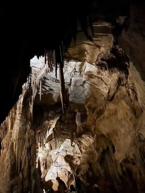
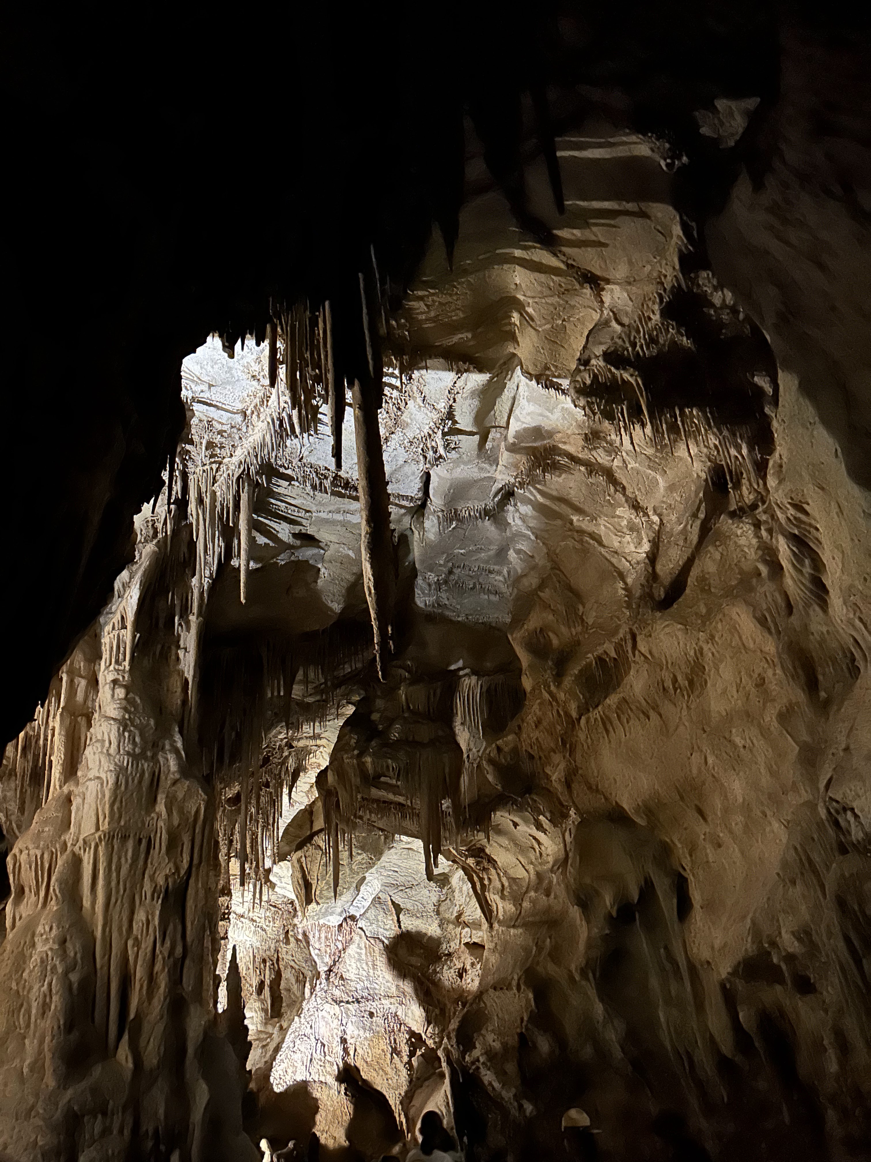
Lehman Caves and Great Basin National Park are a treasure. Timpanogos Cave doesn’t begin to compare. It’s just a stinky hole in the ground compared to Lehman Caves. But not perfect. Our initial tour guide at Lehman was an absolute bitch. My Grandson is on the ‘spectrum' and he periodically has melt-downs, especially when hungry or tired. Before the tour started he started to whine, it was late in the day and he was out of his element, and the tour guide went ballistic:
“that child CANNOT go into the cave until that child can CONTROL his outbursts!”
We tried to explain that he’d calm down momentarily, that he’d be fine, but she’d have none of that. After much talking and trying to convice her of his innocence, the other cave tourers, total strangers, even coming to our defense, but she refused to let us in the cave with my Grandson Madsen. I finally lost it and walked out, demanding to “Talk to management.” Yeah, I melted down to a much greater degree than my grandson. Thankfully, another tour guide stepped in and took over and took us on a wonderful walk through the cave. She even let my grandson wear her ranger hat the whole tour, and he was absolutely thrilled - and quiet - for the whole tour. That Guide saved our day. I’m forever grateful.
Wheeler Peak (13,063 ft) is the high point in the middle, Jeff Davis Peak (12,771 ft) is on the left.
After touring Lehman Cave we drove up to the Wheeler Peak trailhead, and that drive is not easy. From Baker Nevada up to the Wheeler Peak Trailhead, the drive is on a steep, curvy road, gaining over 4,700 vertical feet in about five miles. The hike to the summit of Wheeler Peak is about 4 miles one-way with a vertical gain of just over 3,000 feet. It’s an easy hike, never too steep and not technical in any way. The crux is the altitude and thin air. But we didn’t hike it this trip; no time, had to head for home for work and home duties. . . but next time . . . . But we were headed to a shit-show on the drive home. In hind site we should have just stayed and hiked Wheeler.
Jeff Davis Peak (12,771 ft), high point on the left.
Wheeler Peak
Cool, mostly dead Limber Pine.
Wheeler again from the Alpine Lakes Loop trail.
Change in the air.
Getting ‘some' at Stella Lake with Wheeler Peak watching overhead.
Kara at Stella Lake
Tacoma, the Yugo of 21st century
Damn Tacoma! It’s a 2019 with less than 40,000 miles and the drive belt broke. It died when we were ten miles north of Delta Utah, while driving north on Highway 6. It was 7PM on Sunday evening. There was no traffic, and our cell phones had no signal. Stuck and just off the highway we finally dialed 911, and, surprisingly, got an immediate answer from the Utah Highway patrol. They, in turn, called a towing company in Nephi, Utah. An hour later this tow truck showed up and the driver said he could take us anywhere. We debated on going just to Nephi (he said there were no mechanics in Delta), then getting a hotel room in Nephi for the night (yeah!) then try to find a mechanic the next day. The tow driver said his day job was a mechanic, and that his shop was backed up until mid-week. He guessed that the other shops were equally stacked, so we had him drive us all the way home, which cost us over $1,000. He could have been feeding us shit just to maximize his miles and the fee, but staying in Nephi and looking for mechanic the next day had no guarantees, and he seemed trustworthy, so we rode in his tow truck all the way home to Bountiful, the Tacoma taking a pathetic nap on the flatbed.
My loyalty to Toyota took a huge hit on this one. This is my third Tacoma and I’ve never had any issues, ever! With my first two Tacomas, a 1989 and a 2004, both with standard transmissions, I drove over 500,000 miles and never even had to replace a clutch. Simply put, they were bomb-proof! I never changed anything on them but the oil, the tires and the brake pads. This 2019 is a piece of shit. Two years ago, at just 30,000 miles, that drive belt started whining so I had Performance Toyota in Bountiful replace it, and the whining stopped. Today while driving home from Great Basin NP, I heard a strange whining again. Eight miles north of Delta it got louder, so I stopped and looked, and the belt way very frayed, like it was dragging over a grit stone. Sunday night and in the middle of nowhere, I had no options but to just keep driving for home. Back in the truck I started driving and the whining got even louder. Two miles more and I heard a pop and all the warning dash lights came on, and, being the nervous accountant that I am, I immediately pulled off the highway and shut down. When I looked under the hood there was radiator fluid pouring out of a broken hose onto the ground. Turns out that when the belt broke, the loose end of the belt whipped around a pulley and snapped one of the coolant hoses. It’s a very good thing I’m a nervous accountant, a good thing I didn’t keep driving.
The next day and back home, I asked a neighbor for a tow to Performance Toyota, hoping, since they replaced the belt two years ago, that it’d be under warranty. It wasn’t. The belt warranty was only 12 months. My next hope was that the belt broke due to a seized water pump. If so it would still be covered under the original Toyota warranty. It wasn’t. There was nothing wrong with the water pump, or any of the pulleys or tensioners. In short, they found no reason for that belt to break. All components were in prime working order, they said. Their best guess was that the belt was faulty and it "just broke.” Hmmm, I don’t buy it, but what can I do? No explanation is very puzzling. I’ve never had a belt break, ever. I never replaced a belt, ever, with my first two Tacomas, and did I mention I drove over 500,000 miles in those two Tacomas? The belt was replaced and truck soon back in operating condition, but with no good explanation for the broken belt. Now I’m kind of a wreck. Now I can’t drive three miles to 7-11 for an extra-large Red Bull Slurpee, with a No-Doze chaser, without checking the belt to see if it is fraying. So far it still looks new.
All told, I paid about $3,000 for this little adventure in my 2019 Tacoma: $1,000 tow, $2,000 for a new belt and a thorough check of everything under the hood that could’ve made the belt fail. Total BULL SHIT! Maybe I should have bought the F-150, but at the time the new Fords cost $20,000 more than a comparable Tacoma. Perhaps it would've been worth it? Anyone interested in a 2019 Tacoma?
Kessler Peak is another favorite Wasatch hike, and the God’s Lawnmower Trail from the Doughnut Falls trailhead is my preferred route. It’s short and steep, perfect for after work hike. The trail is heavily wooded with aspens and Douglas Fir, so the hike is cool, green and shady, a nice escape on a hot summer afternoon. I feel some urgency to hike/ski Cardiff Fork because, as of September, the landowners in Cardiff Fork have not renewed the public access agreement with the USFS allowing public access through their land. It’s possible that public access might be denied in the near future. Today I saw signs saying as much - ’No Trespassing’ or ’Not a public Trail.’
Stats - Kessler Peak Summit from Doughnut Falls TH, via God’s Lawnmower trail: One-way distance: 2.38 miles
During the ascent, the trail traverses east to west across the top of the avalanche path/ski run called God’s Lawnmower. From the highway, seen way below, it looks steep and intimidating, but looking up a mountain from the base is often misleading, often looking steeper than it really is. God’s Lawnmower is a prime example. From this vantage point, near the top, it looks benign, it looks like an easy ski run. That said, the absence of mature timber down most of it’s length indicates that it slides big and catastrophically. A warning, ski it only when conditions are welded.
View north-east from Kessler’s summit, the middle ridge line is the Park City divide, separating the Park City side of the Wasatch from the Big Cottonwood drainage.
View south from summit of Kessler. Top of the Snowbird tram on the left, in the middle are American Fork Twins (left - 11,433 ft and right 11,489 ft (hi pt of SL Cnty)). The nearer ridge is Mt Superior (11,040 ft) the high point on the right and Monte Cristo (11,132 ft) is the high point barely cut out frame on the far right.
View east with the near steep/exposed face falling of the Reed and Benson Ridge.
Park City ridge-line, Guardsman Pass the low point on the right, where the conifers and the aspens meet.
View directly north off the summit of Kessler.
View south, Mineral Fork of Big Cottonwood is the near drainage on the right.
Kessler East Couloir a popular ski run because it’s not very steep, about 36 degrees, so the riff-raff descend in hordes.
A vertical mine shaft just below (NW) Kessler’s summit. I’m not sure what mine it is, nothing is listed on my mine maps. The closest mine found is the Carbonate Mine, shown on. the face SE of Kessler’s summit. This could be another access for the miners because there’s a ruin of a miners cabin just down the hill.
Deadfall blown over onto another tree and the live tree growing around the dead.
Ruin of miners cabin near the summit of Kessler (NW about a quarter mile).
On the descent, long shadows stretching over God’s Lawnmower.
The Pfeiferhorn is one of my favorite hikes in the Wasatch. Short enough for an after work pump, but steep and exposed just enough to keep it serious. This is the view looking west towards the Pfeiferhorn (11,326 ft) from the start of the knife-edge ridge.
Stats, from the White Pine Trailhead: Distance: 10.4 round trip miles Elevation Gain: 4,239 feet (with ups/down); 3,652 feet straight line (trailhead to summit without ups/downs of terrain changes)
As technical as it gets. This 'belly-roll' move is the crux of the route, maybe a 5.6 move to get around the bulging boulder. The very positive horizontal crack (my left hand) makes it and easy move, and just ten feet and its done. All the rest is a scramble, and, like most scrambles in the Wasatch, if you get gripped, look around and there's always an easier/safer way. I like this route on the south side of the knife-edge ridge, as opposed to the top side or the north side, it’s cleaner, more direct, no dead-ends. The north side is more exposed, bigger drops and fewer positive holds. Going over the is be less exposed than either side, but it requires a number of moves up and down over pits and and small faces. This move is easy enough that I can hold the edge with my left and hold the camera pole with a fractured right wrist (see below).
But before the knife edge, Red Pine Lake is the reward for the 2.53 mile/2,000 foot gain approach from the White Pine Trailhead. The route to the Pfief is up the string of firs seen diagonaling rightward in the middle of the photo, then up the headwall to the top of the ridge.
After the stout run up from the trail-head, I let my guard down on the flat trail around Red Pine Lake. Futzing with a camera as I jogged around the lake, I didn’t see a wash-out on the trail, stepped off into air-space and face-planted. It really hurt, but I was more concerned about camera damage. The camera was fine, but my wrist was fractured. Required six weeks in a soft-cast. It hurt but I never considered going back, still went tho the summit. These moments don’t come often anymore, age and family requirements ever expanding, they can’t be wasted.
View of Red Pine Lake from the top of the headwall.
Timpanogos from the approach ridge just above the Red Pine Lake head-wall.
Summit of Pfeiferhorn, 11,326 feet. View SW towards Utah Valley and Utah Lake.
Red Pine Lake before starting down the Red Pine Headwall. The headwall is steep and loose but not dangerous with careful foot placement.
Some rain on the descent. This time I watched the trail around Red Pine Lake.
Red Pine Lake (9,602 ft)
Engelman’s Aster or Eucephalus Engelmannii.
Aspen Fleabane, or Erigeron Speciosus, which in latin means good-looking, handsome or beautiful.
Glacial scars, when rocks imbedded in the glacier are dragged over the bedrock with the movement of ice. I love seeing these geologic signatures, it gives a feeling of a much greater power, whether merely glacial ice or the power of a Deity, it’s humbling and awe-inspiring to realize how small and inconsequential we really are. Nature is much larger than any human creation, especially politics/religion. Talk to the trees, talk to rocks, talk to deserts and mountains, feel the power.
Maybird bridge collapsed under last year's deep snowpack. In all fairness, that bridge has got to be over 40 years old, it was there when I was in high-school, the late 1970’s, and I’m not aware that it has ever been rebuilt. When I was about 15, in 1977, I was hiking here in the spring with my Dad and brother Mark, the snow was about 10 feet deep and there was a deep trench due to the rushing stream eroding the snowpack from below. There were two hikers on the opposite side trying to get across, but it was a dicy, scary situation. If they fell into the trench into the rushing water they’d never get out, they’d likely drown when the water pulled them under the snow. My Dad found a dead-fall Douglas Fir and broke off the narrow top 20 feet off the trunk. My Dad yelled over to the hikers to throw their packs and gear over, which they did, and Mark and I rushed to grab it before it fell back into the watery trench. Once all their gear was safely over my Dad extended the tree trunk for them to grab, to use as a hand rail as they jumped over the trench, then use as a hand-hold while they dug into snowbank for secure purchase. Once over they said they had been camping in Hogum Fork. Three days earlier on their ascent, there was no trench and no open water, they simply hiked right over stream, hearing the rushing water deep under the snow.