Sunday, January 26, 2014

Ben Lomond via Cutler Ridge, January 27, 2014


Ben Lomond from the east, half way up Cutler Ridge. About five years ago we skied 6-inches of powder the first week of June in the trough down the face (lookers right of the tree-line descending from the summit). 

James Peak (aka Powder Mountain). The timbered slopes to the left of James Peak is private property, leased to the local helicopter outfit, which is extremely defensive if you're thinking of poaching a line or two. The State of Utah wants to privatize all the federal land within its borders, which means I'll be an outlaw if I ski (or hike or bike) anything that I currently ski (or hike or bike). My vote is to leave our public lands under federal ownership and keep it open to the public, otherwise I guess I'll become an outlaw. In my lifetime I've seen many, many trails along the Wasatch Front closed to public due to encroaching development, wherein trophy homes are built high on the Wasatch foothills and traditional trail heads are gated.      

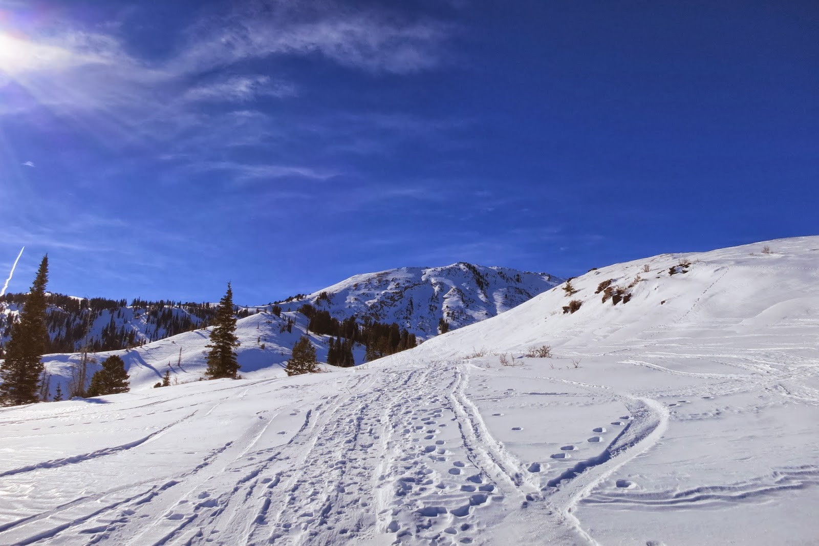
The snow may suck but the sun feels good on your face. We haven't had a storm in three weeks and the snow we do have is about 50% of average depth. 


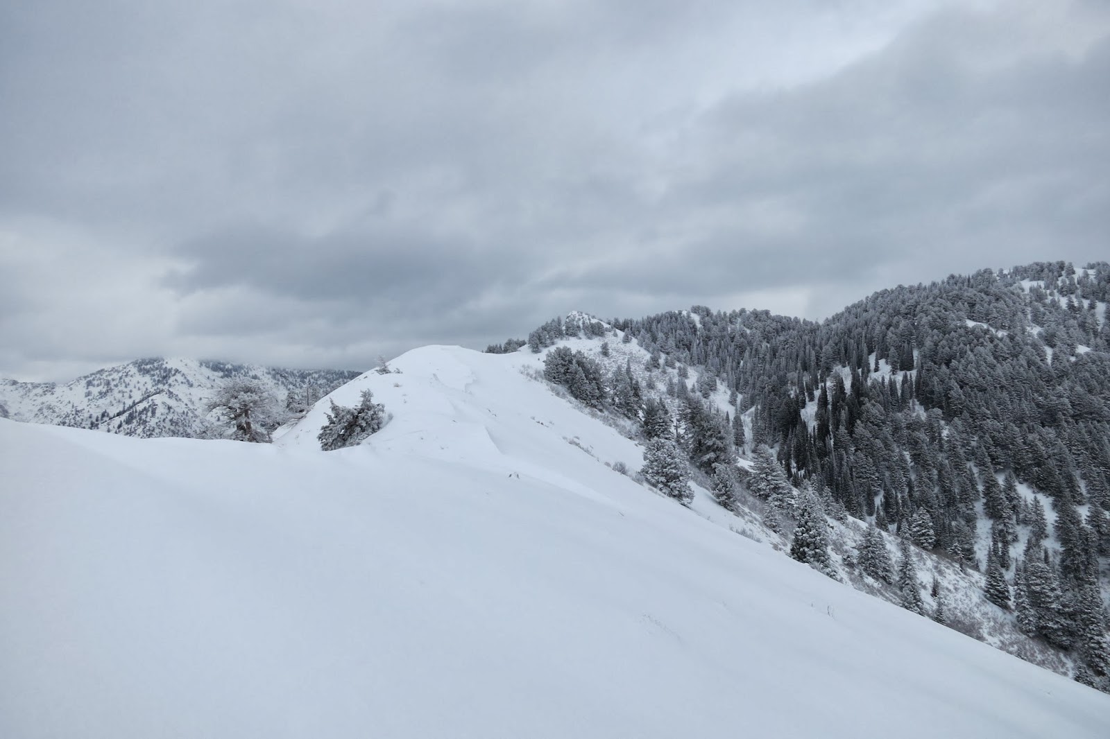
What? How many skin tracks do we need? You'd almost think this was in the Cottonwoods. That is Ben Lomond straight ahead, with a spiders-web of skin-tracks heading to every skiable line.   

More skin tracks.

SE face of Willard Peak from midway up Cutler. 

The Sheik of Araby pointing out ski lines taken in bigger snow years. 

Cutler Basin and Willard Peak.

Brett topping out on the ridge, looking SW toward Ogden. This is the last 'flat' before starting up the head wall to the summit of Ben Lomond. See that smog out there? Really strange, but it stopped along the Weber-Davis County line. Antelope Island is peeking out, barely seen on the right, just above the steep, treed ridge, and with the Stansbury Mountains (Deseret Peak) just above Antelope Island. The Oquirh Mountains are to the left of the Stansbury's, just right of Brett's head. Davis and Salt Lake Counties should give up their smokes. 


Brett pointing out more ski lines.

Ben Lomond's summit in the sun on the right. We booted up this face, the snow was too hard to skin (no purchase) and too soft to support our weight, punching through about every third step. Should've brought the ski crampons.

Brett putting skis on pack, the other dude putting crampons on skis. We met 'Crampon Dude' at the saddle.

'Crampon Dude' cruising.

 'Crampon Dude' did much better ascending this steep face than us 'Boot Dudes'. This spot was supportable, but every few steps we'd punch through to over our knees.  (photo by Brett F.)

Sastrugi!! Ski conditions were not the best, but you can't expect much when it snows once every three weeks. (photo by Brett F.)
Brett booting the ridge, Ogden Valley below (Eden, Hunstville, Pineview).


Brett nearing the summit of Ben Lomond, Willard Peak on the right.

Near the summit, the south face of Ben Lomond, seen so prominently from
Ogden, is on my left (lookers right). (photo by Brett F.)


View NE from the summit of Ben Lomond. Willard Bay, middle left, promontory Mountains, upper left, Willard Peak on the right and 'Crampon Dude' getting ready to ski. My Dad grew up on the edges of the Great Salt Lake, seen to the north of Willard Bay. As a depression era farm-boy, he carved his own ice-skates, strapped them to his boots and skated for miles and miles along the edges of those frozen marshlands.  

View west from the summit of Ben Lomond.

View North. While in the wind the skis on my pack acted like a sail and tossed me a bit while hiking the summit ridge.
This photo makes me cringe. I like my new Black Diamond 'Dawn Patrol' pants, until I see myself in print. B.D. sizes them with an 'athletic' cut (their terminology, not mine), which meant I had to size up the waist two inches (34 rather than a 32) in order for them to fit my ass. For the most part they do the job, but the 'Cowboy in Wranglers' look doesn't really work with my large ass and 'rugby-type' lower body. I've never claimed, or even fantasized, that I was some super athlete, but does one really need to be anorexic-thin (the body of a pre-pubescent teenage girl) to be an athlete?      

View south, City of Ogden below.


Bad, thin, old, old snow, but some of the protected, north aspects still offered fun, creamy turns. 

Saturday, January 11, 2014

BC Skiing: Bountiful Ridge-Rectangle Bowl, January 10, 2014

Rare scene: unbroken snow in lower North Canyon. The good thing is very few travel past this point. More skiing for me!
 
Trail breaking was kind of tough with a foot of fresh powder over a foot of rotten snow. It often left me sinking to the ground.  


My view, all the way to the top of Rectangle Peak on Bountiful Ridge (the S.L. and Davis County divide), NE of Rudy's Flat.

Moose tracks. I was in upper North Canyon when an ass-hole in a helicopter flies over . . . and over and over. He flew circles overhead, just 50 feet off the ground for nearly an hour; it sounded like a scene out of Apocalypse Now. He did 'touch and goes'  along the ridges and peaks of North Canyon and he totally spooked a big bull moose who came charging through forest about 100 yards above me, through the 28 inches of snow. I've seen moose up there for years and in the winter they stand like statues, not moving a muscles for hours at a time, conserving their strength to endure the cold and wet weather. I see this pilot flying up there every time I ski Bountiful Ridge and he's always doing his cute fly-bys, and touch and goes, scaring the crap out of the Moose that winter near Rudy's Flat. I'm going to find out who the pilot is and file a complaint with the Forest Service, for harassing the wildlife. For a moose to run through deep snow in mid-winter, it's a huge drain of their reserves; it can weeken them to the point of death. I'm not alone is this complaint; in the summer I've seen him do the same and I've heard cyclist echo my thoughts. As I see it he can do touch-and-goes at the airport-port, the landfill, over Energy Solutions nuclear repository, or the sewer company, or even his own neighborhood, and he won't bother the moose, skiers, bikers or hikers.  Heli-free Wasatch!!     

27 inches of snow at Rudy's Flat (7,140 foot elevation). Pathetic winter so far; the 12 inches that fell yesterday were a real blessing . . .

 . . . but we need more, a lot more.

The City of Bountiful from mid-slope, half-way between Rudy's Flat and Rectangle Peak. 


32-inches of snow half-way up Rectangle Bowl, which is about 3/4 mile and 1,000 vertical feet above Rudy's Flat (8,100 foot elevation).

24 inches just below the summit of Rectangle Peak (8,400 foot elevation). I skied this SW facing slope knowing I'd hit rocks but also knowing it was the safest aspect to ski given the current avalanche situation (moderate to high depending upon location). The slope angle here is 37 degrees, which is prime steepness for avalanches. I watch this slope all winter long and the snow stabilizes here more quickly (and does not accumulate) than the slopes just around the corner on the N-NE aspects. This slope was nearly melted off before yesterday's storm. I had several thing in my favor avalanche wise: low elevation, SW aspect (direct sun creates freeze/melting cycles which create more stability than on the N-NE aspects, which see little sun) and little snow. Yeah, I heard collapsing along the ridge where the wind had made deposits, but on this slope the snow was very stable. I did hit two rocks near the summit, where the wind had carried off much of the new snow.  

My turns and skin track in lower Rectangle Bowl, and this frame shows about 1/4 of my run. Slope angle down here is about 25 degree. The angle from the top of the frame to the top of Rectangle Bowl is a consistent 37 degree.  

First run turns in upper Rectangle Bowl.

First and second run turns in upper Rectangle Bowl. The skiing here is great, but the lifts SUCK!

Skiing home, just above Rudy's Flat. A thin snow-pack in trees and I was moving fast - not a good combination! I panicked when I came upon this log with no time to stop, so had to commit and tried to hop but not sure if my skis would go over or under.  Luckily they went over. Lesson learned: slow down in thin conditions.

Another dead tree at Rudy's Flat. I rode my mountain bike up here about 50 times last summer and never noticed this dead tree, which is just 5 feet off the trail. I love the slow pace of backcountry skiing. Skinning through a forest, you see things missed while pushing the pace on a bike.   

Rectangle Peak (middle, 1/3 frame from right), Rectangle Bowl - site of today's ski runs (open slope directly below Rectangle Peak), and Rectangle Run still too brushy and begging for snow (the open, but brushy, slope left and down ridge from Rectangle Peak).

 
Weirdness of nature. This wishbone-shaped branch fell from the upper reaches of this tree and has hung here for at least the last ten years. Ok, not that weird, but it tickles me to see this each year. Some things endure. Some things fade away.    


View NE from the summit of Rectangle Peak, towards the Burro Mine area of Bountiful Ridge. That pointy, brushy knob in the middle of the frame is what we called Black's Peak as kids. I'm not sure where that local name originated, maybe from Black Mountain which across the canyon to the south (City Creek Canyon). Although, years ago I saw a USGS top map that had this peak labeled as Big Black Mountain and the one in City Creek Canyon labeled as Little Black Mountain. Current USGS maps do not label it as such. Just Burro Mine. 

Who's the dork? Colors not coordinated, garbage bag and PVC pipe. What a hill-billy!!! He probably even likes Earnest T. Bass. He probably drives a 10-year old Toyota, and a stock, 12-year old triple crank, instead of an Escalade and $10K S-Works. He should get a rope and use it! He'll never make it at Deer Valley, Snowbird, Alta or on the local cycling scene. But wait, this is not a resort and he's no cyclist. His location is hours from town and anyone who cares about fashion would never hike this far - through weeds - for a paltry 4,000 vertical of skiing. Normal folks get that much skiing in 20 minutes riding lifts. Oh well, Earnest T. Bass would be proud.